Différences entre versions de « G rect - Une boite à outils Matlab pour géoréférencer des images »
Sauter à la navigation
Sauter à la recherche
| Ligne 16 : | Ligne 16 : | ||
svn co <nowiki>http://bourda02@demeter.uqar.ca/svn/g_rect/trunk</nowiki> | svn co <nowiki>http://bourda02@demeter.uqar.ca/svn/g_rect/trunk</nowiki> | ||
| + | |||
| + | |||
| + | = How to use the package = | ||
| + | |||
= References = | = References = | ||
Version du 30 novembre 2012 à 17:19
Introduction
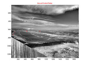
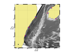
This toolbox contains a series of Matlab functions for georectifying highly oblique digital images. This is useful in oceanography for obtaining quantitative information on sea-surface patterns such as those induced by internal waves, fronts or sea-ice.
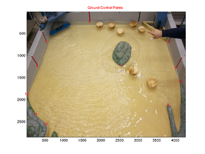
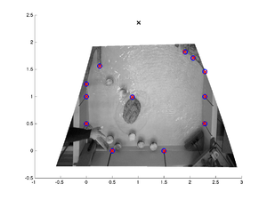
Although this toobox was initially developed to georectify geophysical images it can be used just as well for rectifying laboratory images. The following images show examples of such image rectifications.
How to get the package
svn co http://bourda02@demeter.uqar.ca/svn/g_rect/trunk
How to use the package
References
- Bourgault (2008), Shore-based photogrammetry of river ice, Canadian Journal of Civil Engineering Media:Bourgault_2008.pdf.
- Bourgault et al (2011), Field observations of a large-amplitude internal wavetrain and its reflection off a steep slope, Journal of Physical Oceanography Media:Bourgault_et_al_2011a.pdf .
- Pawlowicz (2003), Quantitative visualization of geophysical flows using low-cost oblique digital time-lapse imaging, IEEE Journal of Oceanic Engineering Media:Pawlowicz_2003.pdf.


